
HYDROGRAPHY & BATHYMETRY
MAPPING THE SEABED WITH PRECISION
Integrated systems suited to both very shallow waters and offshore operations.

NORBIT iWBMS
Compact multibeam echosounder for high-resolution bathymetric mapping, from coastal waters to offshore operations.
·200–700 kHz ·
·512 beams
· 210° swath

ECHOTRAC E20
Single-beam, dual-channel echo sounder for hydrographic surveys and depth control.
·10–250 kHz
Dual channel
· Up to 1,000 m
MARINE GEOPHYSICS
SEEING WHAT LIES BEYOND SIGHT
EDGETECH 4200 & 4125
Lateral bottom imaging and object detection.
300/600 kHz
Up to 2,000 m
·Dual frequency.


GEOMETRICS G-882
High-sensitivity marine magnetometer.
·UXO detection
·Towed system.
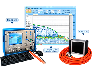
INNOMAR SES-2000
Parametric sounder for exploring sedimentary layers.
·2–22 kHz
Penetration 40 m
High resolution.
SUBSEA INSPECTION
OPERATING EVEN WHERE ACCESS IS DIFFICULT.

ROV REVOLUTION
Powerful and modular ROV for complex inspections, with 4K camera and specialized sensors. Depth 300 m
4K Camera
• Battery life 8 hours.
ROV DTG3
Compact and agile platform for inspections, retrievals, and rapid interventions. Depth 200 m
• Compact format
• Rapid deployment.


OCULUS SONAR
High-resolution acoustic imaging for locating and inspecting targets in severely reduced visibility.
· Turbid waters
· Real time
· High resolution.
ENVIRONMENTAL SURVEYS & SAMPLING
MEASURING AND SAMPLING THE MARINE ENVIRONMENT
Measure and sample the marine environment without altering it, using suitable probes, grabs and corers.

SEDIMENT SAMPLING Grabs and corers suited to muddy sediments, gravel and environmental surveys.
· Mud & gravel
· Coring
· Up to 5 m.

WIMO MULTIPARAMETER PROBE Characterization of the water column according to the parameters required by the mission and the study protocol. · Oxygen
Turbidity & pH
Chlorophyll.
POSITIONING & DATA ACQUISITION
SYNCHRONIZE EACH MEASUREMENT
Synchronise every measurement through an integrated positioning and data-acquisition chain, both onboard and ashore.

GAPS M5
USBL system for precisely locating underwater vehicles, sensors and targets.
· Up to 995 m
• Accuracy 0.2%
GNSS & Inertial Measurement Unit
RTK positioning and motion compensation for reliable georeferencing of each measurement.
RTK
Centimeter precision
Real-time

MARINE ASSETS
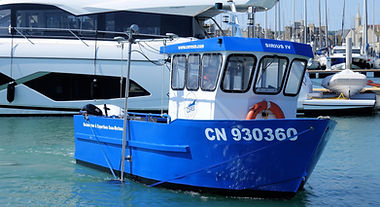
A FLEET ADAPTABLE TO EVERY OPERATING AREA.
A fleet adaptable to coastal, offshore, port, lake and river operations.


Coastal, offshore, port, lake or river: the platform is chosen according to the objectives, access and constraints of the site.
· CERES III
· HYDROGRAPHIC SHIP
· LIGHT BOATS
A CONTROLLED MEASUREMENT CHAIN
From positioning to data interpretation.
OUR METHOD:
- PREPARE — Selection of sensors, protocol, calibration and interfaces.
- ACQUIRE — Real-time tracking and adaptation to the terrain.
- CONTROL — Data coverage, quality and consistency.
- INTERPRET — Processing, mapping and rendering.
- QUALITY & SAFETY — Recognized qualifications and procedures adapted to the requirements of each mission.
YOUR PROJECT — A SPECIFIC REQUIREMENT?
Our teams work with you to define the most suitable combination of resources.